Sunday, June 24, 2012

Adirondacks Day 5 (B) - Sun 6/24/12

Part 11, Rocky Falls... Again

Rock Garden trail
The first part of the Long Trail down is steep, but it is much better than coming up, so we make good time. The ground is damp and slick in places, so the desire to move briskly needs to be balanced with the need to be careful of footing. Downhills tend to be tougher on my knees than uphill, and I notice (not for the first time on this trip) that I have not felt a single twinge of any sort in my knees while we have been here. That is unexpectedly good, and a nice counterpoint to the persistently aching heel, which is not so good.

11:33am - Partway down the mountain we get to the junction of the Rock Garden and Long Trails. We head west on the Rock Garden Trail. This trail roughly parallels the route up, but further west, and joins the main trail a ways further out toward Rocky Falls than the Long trail. If nothing else, it will give us a fraction of a mile on a different trail from the one we just came up on.

Chute at Rocky Falls with cairn
After a few minutes on the Rock Garden trail, we come to a junction with a trail heading west. We take the western trail, but we pass a few things that don't look familiar. We have come this way three days before, and something isn't right. I ask for a stop to check the GPS and map, and am convinced that we are on the ski trail to the top of Nye Mountain. Just as I am arriving at this conclusion, an older couple comes down the trail from the west and confirms that to be the case. On the down side, I seem to have a habit of ending up on ski trails on this trip. On the plus side, when I stop to look at a map and GPS, I am pretty good at figuring out where I am. We double back and get on the right trail amidst jokes that Leo and I should have packed skis.

11:46am - We reach the junction of the Rock Garden and main trail and head southwest toward the Falls. Now the trail looks familiar again. We plow ahead at a decent pace, as this trail is easy, being fairly level and cut periodically with feeder runs and runoff culverts, put in place and lined with rocks to keep the trail from washing out.

Me on Rocky Falls
12:40pm - Rocky Falls again. We come out the same place we did last time, and make our way up the stream bed. At one point I slip off the side of a rock while crossing the stream and dunk my left leg in the water up to the knee. Lovely. Step, squish, step, squish, step, squish, step, squish...

We stay at the Falls for a solid half hour, eating sandwiches, taking off shoes and socks, and spending time wading around in the cold (but not frigid) water, and climbing around on the rocks. People have brought extra clothes and swim shoes, but the cold water prevents anyone from going in more than wading. Some of the few out of the 219 pictures that I take that actually have me in them are taken here by Phil. I put my socks and wet shoe on a sunny rock and hope that I can dry some of the squish out of them before it is time to head back. Wet stuff is great for creating blisters.

Mount Jo and Rocky Falls - 6.7 miles total
While we are here, a number of other hikers come by, take pictures, and move on. By the time we are ready to go, my socks and shoe are nowhere near dry, but they no longer squish when I walk, for which I am grateful. The return hike is boring, as the trail is not very interesting, and this is the fourth time along it (twice out and now twice back). It is also anticlimactic, as I know this is the last piece of hiking that will be done on this trip.

2:15pm - Back at camp.

The track at right shows us leaving the campsite, heading counterclockwise around to a quick stop at the store, then more counterclockwise to the main trail to Mount Jo. The Long Trail leaves the lake shore heading north and then curves west and north/northeast onto the summit of the mountain. The Rock Garden trail and our detour onto the Nye Mountain trail is the curve further west, and then the obvious out-and-back to Rocky Falls.

Next... The End of the Line

Adirondacks Day 5 (A) - Sun 6/24/12

Part 10, Mount Jo

7:15am - I finally haul my chilly self out of bed. I have been awake for a while, but I was cold at times during the night, and my sleeping bag is nice and toasty, so I have a bit of trouble mustering an urgent need to get out of it. I am typically warm, and I am surprised that I made it through the entire night wearing everything that I had on when I started. Dave apparently shed a layer or two during the night, but I didn't.

Some big boys from Mount Jo - (L-R)
Wright, Algonquin, Iroquois and Wallface
Others have been up for a while, and breakfast preparations are well underway. Since we are nearing the end of the trip, breakfast is an assortment of hot leftovers; a few bits of bacon, some sausage and a few eggs for those that want, plus all sorts of other cold items that we have lying about. It's getting close to "now or never" on the food. I eat some scrambled eggs and toast, but as good as everything looks, I am not feeling that well. Actually, I am feeling perfectly fine, but I do seem to have to have some gastrointestinal "not quite right" going on (too much information, I know, but I am just telling the truth for posterity...). I am really not happy about this development, as this is not an ideal accompaniment to long hikes out in the woods. I will hope for the best, but prepare accordingly. Ugh.

Our intrepid band (minus one, and me) on
the lower summit of Mount Jo
While eating breakfast, we discuss what we are going to do. Dave has a different plan. The four of us (minus Dave) have decided on a relatively modest hike up to the top of Mount Jo, and then down and back out to Rocky Falls on the Indian Pass Trail. We will pack a lunch for Rocky Falls, and if people feel like it, perhaps get into the water. This will make a hike somewhere in the vicinity of 6 total miles, and will have some climbing to it, but nothing extreme at all. Mount Jo is 2,877 feet, and the lake surface is 2,165, so the gain is modest, but it happens in short bursts, as the Mount Jo portion of the trail is less than a mile each way, so while it is only 700 feet of elevation, it happens quickly. I still do feel the need to get to the top of something, and this should fit the bill. It is a nice hike, modest in scope, and modest in climbing. Perfect for a non-killer day.

Me on top of Mount Jo
Another option discussed, and one I would have pushed strongly for if I were not having issues, was to hike approximately 6 miles out the Indian Pass Trail to Indian Pass itself, in the shadow of 3,700 foot Wallface Mountain. It seems to me like this is something that would have generated some of the kind of scenic photo opportunities that I have been craving, and not generally finding. The other appeal of that hike is that while it would be in the neighborhood of 13 miles roundtrip, there would be very little climbing involved, and what there was would be accomplished over a very long distance, and hence very gradual. My problems come with climbing, not distance. But on this day anyway, it wasn't to be.

8:02am - Dave finishes packing food and liquids and sets off alone to tackle Algonquin. I'm not sure how set he is on doing all of it, but the general campsite chit chat consensus is that another Adirondacks trip is unlikely (for these trips anyway), so I guess he is feeling like it is now or never. Others shudder at the thought of climbing from 2100 feet to 5100 feet in 4 miles (Marcy is to 5300 feet in 7.4 miles). Dave's back must be feeling 100%. I am slightly concerned that he is doing this alone, but he probably has the best judgement of all of us, so I'm not overly worried.

True summit of Mount Jo
9:30am - Four of us set out for Mount Jo. The first section of trail I have done before when we went to Rocky Falls on the first day, but we soon reach the side trails up the mountain. We need to decide whether to do the Short Trail or the Long Trail, and we opt for the Long Trail. This does the same amount of climbing in 0.7 miles vs 0.4, and we are in no hurry so the mileage doesn't matter. It will be quick either way. The ascent is brief but difficult at times, but it is so short that the tough parts don't last long. It is also interesting that on a trail that shows no junctions, there are a couple of places where there seem to be two choices of which way to go. We do not make any wrong turns at this point, but there seem to be some side trails that are not on the maps. After my Table Top Mountain escapade on Friday, I have no qualms about pulling out my GPS and map to figure out which way we should be going.

Heart Lake from Mount Jo. Campground is on left
shore, and my pics are taken from there
10:43am - One last climb up some hand over hand boulders and we reach the lower summit, which is basically a rock shelf 15-20 feet below the real summit. Finally, after four days here, there is a vista and a fantastic photo spot. It is breezy and cool up here, and you can see many miles. It is great to be standing on top of a mountain, no matter what size. The view is everything that it was said to be; many of the big name mountains can be seen, and the view of our little lake below is spectacular. We know that we are not quite at the true summit yet, as there is one last rock shelf behind us, and we can hear a number of voices coming from up top. I am content to stay here and take some pictures here, where we have the place to ourselves, at least for the moment. Symptomatic of the times we live in, there is great cell reception on top of the mountain, and we take turns taking pictures of each other with our phones so we can text or email the pictures to our loved ones, or post them on Facebook.

Mountains, forest, and clouds
10:55am - A few more boulders to hop and we join the small crowd on the true summit. There are approximately 15 people up here besides for us, including families, grandparents, and children. Mostly speaking French. Pictures up here are even better. I make sure to step on every obvious high spot up here; I don't want to miss the true summit, since there is no marker on this small one.

11:20am - After twenty minutes or so on the summit taking pictures, enjoying the view and having a brief snack, we start back down the way we came. There is a fairly steady stream of people of all types heading up, as there was when we were coming up. We even saw a guy with a baby in a carrier on his back. It is a beautiful clear day, and it is great to be out on a trail. And I am happy to have summited something.

Next... Rocky Falls Redux

Saturday, June 23, 2012

Adirondacks Day 4 (B) - Sat 6/23/12

Part 9, Dinner Feast

At around 5pm, the sun comes out, skies turn blue and the remainder of the daylight hours are gorgeous, if a little cool. I am wishing that I had gone for a short hike, but by the time I finally make up my mind that I should, it is too late.

Ribeye dinner
Before it gets to cooking and dinner time, we all wander down to the Loj for some wifi and to stretch the legs. I take yet another batch of lake pictures, as the post-rain light is different and the mists are rising off the water. A few people have rented kayaks and are making their way around the shoreline.

5:00pm (ish) - Leo gets a fire going for dinner, and to take the damp chill out of the air. We had the foresight to stash the firewood in the party tent, so even with the rain our wood is dry and the fire starts easily. Our downhill neighbors apparently didn't do the same, as their fire is a smokey mess, and the breeze is such that we are taking the brunt of it. Of course, I guess it's also possible that this is a planned attack out of revenge for us giggling at his naked wife/girlfriend (but probably not...). There is joking talk of having to declare war on Quebec, but fortunately it doesn't come to that (and perhaps a good thing too, as we would be vastly outnumbered right at the moment). The majority language being spoken around us (and by virtually everyone passing by) is definitely French, not English.

Van Hoevenberg Plaque
6:30pm (ish) - Dinner prep begins in earnest. Phil has a half dozen large ribeye steaks that he has seasoned and frozen for his birthday dinner. They look tremendous. This idea of menu planning, prepping and freezing main courses ahead of time is working out very well.

7:30pm - We sit down to a feast fit for a king. It's been a big calorie/low activity day, between the big breakfast, wing and beer lunch and this, but according to Phil's pedometer, he burned over 7,000 calories yesterday, so we're good, right? Also on the menu is an Uncle Ben's rice pilaf from a box that proves to be surprisingly good, a saute of zucchini, yellow squash and multicolored peppers, and garlic bread. Pam olive oil cooking spray is a wonderful thing. We are eating almost too well. Almost. Phil has a bottle of some rose kool-aid wine that he likes (and was actually drinkable, for a picnic wine), while Leo had a disposable carton of Cardinal Zin, an old vine zinfandel of good quality that was delicious with the steak.

Heart Lake after rain (8:49pm)
By the time dinner was eaten and cleaned up, there wasn't that much daylight left, but I went down to the lake again for the solitude and to take a few pictures. It was a very nice evening with mists continuing to rise off the lake. There were still a few kayakers out along the far bank, and while I was sitting there one of them startled a beaver. From across the lake, I could hear the slapping of its tail against the surface of the water as a warning. I wish I had been able to see it as well.

Time is going fast now, and it is hard to believe we have one more full day and then it is time to drive home. We have some discussions about what to do tomorrow, but no plans are set. Everyone wants to use our last day to do something good, we just aren't sure what. Dave is thinking of taking on Algonquin, the second highest peak. I'm not. Whatever I end up doing, my plan is that Mount Jo will be at least a part of it. Mount Jo isn't a large mountain, but as noted before, the views are gorgeous, and I need to get to the top of something. I need some hiking pictures from this trip that aren't "green tunnel" and rocky streams.

Kayak in the Mist (8:53pm)
The later evening revolves, as always, around the fire, along with Dave and the guitar. It's been nice having music, and I am very impressed at how nice his $200 travel guitar is. He certainly seems to have done his research well and found himself a low cost quality instrument. His impressions of the guitar post-trip are here.

Before heading to bed sometime after 10, we all wander out in to the open area in the middle of the campground and check out the stars. The sky is clearer than it has been any other night here, and there are a multitude of bright stars. It is cold, and expected to drop to around 40 degrees overnight. I go to bed in a t-shirt and fleece pullover as well as long johns and sweat pants. I would rather be warm and remove something during the night than to be cold and have to fish for something in the dark.

Next... Mount Jo

Adirondacks Day 4 (A) - Sat 6/23/12

Part 8, A Lazy Day

Happy Birthday to Phil!

He-Man Breakfast
7:25am - I am last one out of bed, as usual. I slept well and stayed warm except for a few times when an exposed hand or arm got chilly enough to wake me and require burrowing it back into the sleeping bag. The overnight low was in the low 50's and I slept in long johns and a long sleeve t-shirt. It was nice sleeping.

Phil has two frying pans in the fire and is starting bacon when I get up. The only real planned thing for today was to eat a giant breakfast, and Phil doesn't disappoint. We have eggs, bacon, sausage, more onions and peppers, home fries and toast. It's an absolute feast, and quite a production in the making. Any pretenses we have had about keeping away the bears and other critters seem less relevant as we drip bacon grease all over the place. If this doesn't attract every critter within miles I don't know what will. But it is true what they say... bacon makes everything better.

Breakfast Production
9:00am - Breakfast time. Conversation around the table centers around what to do today, with everyone being leg-weary and the forecast calling for a good chance of some rain. Never having been here before, I want to take the van into Lake Placid and look around some, even if nobody else wants to go. I would at least like to see whatever can be seen from a brief drive by, and find a geocache or two if possible. Phil likes the idea, and soon everybody has agreed that we will head into town after breakfast. Phil then declares a birthday lunch plan of wings and beer at a place in town, and nobody objects even a little.

10:00am - Breakfast is done and cleaned up. People spend the next hour and a half showering, and doing all sorts of miscellaneous tasks. I do one of the things I always seem to do when we are in camp and I have a few extra minutes - wander down to the lake and take more pictures. I am getting to the point where I have taken the same shots in all sorts of different light and different times of day, but I fell like shooting something, and don't have the time to wander too far off.

The Lake... again
11:30am - Everybody is in the van and heading for Lake Placid. The sky to the south and west looks very dark and foreboding as we drive out the access road, and we can see a wall of rain off in the distance. As we approach town, a few scattered drops hit the windshield, and it is cool to see the ski jump towers as we drive by. In Park City, Utah, the ski jumps were carved right into the side of a ridge. Here, the landing areas are on slopes but the towers are free standing metal structures. It is hard to imagine that the 1980 Olympics here were already 32 years ago. It's also hard to imagine where all the people stayed and how anybody got anywhere, as this is a little resort town, and the road network is tiny. It is beautiful out here, but there are very limited roads in, and the nearest cities (and airports) of any size are Albany and Montreal, both a couple hours away. Traffic must have been a nightmare.

Lake Placid ski jump towers
We park in a public lot near the post office and find a cache about 20 feet away. We start down the street and almost immediately it begins to rain. It is right around noon, so we duck into the Arena Bar and Grill right across from the Olympic Center (presumably the site of the Miracle on Ice hockey game), and order lunch to wait out the rain. Lunch is good. I stick to iced tea since Phil is living up to his wings and beer lunch plan, and the beer is flowing liberally around the table. We take our time as the rain is coming down hard and steady. This would not be a good day to be attempting Marcy, or any other mountain for that matter, but the parking lot for the trailheads were all full when we left, so there are a lot of hikers getting wet out there today.

Lunch drags out a while as we wait for the rain to let up, but eventually it does and we head back to the van. There isn't much to see, so we restock the beer coolers at a place on the way out of town and head back to the campground.

2:55pm - Back at camp. The rains are mostly over with just a little dripping from the trees overhead, so we pull out the chairs and sit around and talk, read, or whatever. There is a red bellied woodpecker working around the bases of the trees all around us, pecking very lightly. Pretty.

I feel like doing something, so I briefly consider hiking around the lake, or over to Mount Jo, but the skies are still somewhat dark and I'm not sure what the weather is going to do. Staying and being lazy wins out.

Next... Dinner Feast

Friday, June 22, 2012

Adirondacks Day 3 (B) - Fri 6/22/12

Part 7, After Marcy

After getting back to camp a little after noon, Leo and I rest for a while to cool down, and then eat lunch of the sandwiches we packed for the hike. We putter around camp for a while, and I go and get a shower. Getting the grime and sweat off makes me feel better, but despite only having gotten as far as we did, I am still weary.


2:00pm (ish) - No sign of the others yet, and it is a nice quiet afternoon now, so I decide to lie down in the tent and see if I can doze off for a short nap. I slip in and out of a light sleep, but never drop off completely.


2:30pm (ish) - I hear the others come back into camp, but am only half awake, so I decide to lie in the tent for a few more minutes before getting up to see how the rest of their hike went.

Relaxing
4:20pm - I open my eyes to the sound of the guys moving around camp and laughing about something, so I get up and go join them. It turns out that my short nap turned into a two hour plus snooze, but I do feel refreshed (if still leg weary). By now everyone else has showered and cleaned up as well. They are tired but very happy, having summited Marcy in beautiful weather, enjoying the views from the summit  and basking in their accomplishment. (I will link to Dave's blog entry here when he finishes writing it...). I am happy for them, as they have met their long-stated goal of revenge on Marcy.

The remainder of the afternoon and evening are spent in camp, relaxing, talking, drinking and doing nothing in particular. One of the discussion topics that comes up is regarding possible destinations for the 2013 trip, but more on that later.

Late in the afternoon, a French Canadian couple shows up at the downhill campsite next door (#11) and begins unpacking a lot of gear. In addition to bringing out everyone's faux-French accent for the remainder of the trip, some of the gang (me not included) get a cheap thrill when the woman (quite attractive I might add) decides to give a peep show while changing in their tent with the door open. There is much joy in this, and possibly a couple minor cases of whiplash. Boys will be boys.


6:00pm - Leo begins making a fire to cook dinner on, which we eat at around 8pm. Dinner consists of hamburgers and hot dogs, with grilled onions and peppers on the side, plus corn on the cob. It's another simple dinner that tastes great made and eaten in this setting. The mood is good, with the guys happy about the day. Dave plays. We talk. We have a few drinks. Life is good.

Being that it is a Friday evening in the summer, it is very definitely getting more crowded as the day goes on, with more and more campsites and parking spaces filling up. The majority of the people we hear talking are speaking French, and the majority of license plates are from Quebec. Another couple arrives in the fading light and sets up camp at #8, next door uphill.

10:00pm (ish) - Dave and I head to bed. After today, tomorrow is planned to be an easy day with nothing specific on tap.

Next... An Easy Day

Adirondacks Day 3 (A) - Fri 6/22/12

Part 6, Mount Marcy

Marcy Dam remnants
5:15am - Up and out of the tent. I have been dozing restlessly since first light nearly an hour ago, but I can hear the others moving around outside so it is time to get up. As early as the hour is, the excitement of the "big hike" day gets me out of bed easily, and I am not a morning person. I am usually the last up, which is fine with me.

This is the day these guys have been talking about and waiting for since 2008 - the day they attempt to get their revenge on Mount Marcy. They successfully summited the peak in 2008, but weather and visibility were so bad they couldn't see anything, and they were so miserable they couldn't stay on the summit (not that there was any reason to at that point). There is a palpable excitement in the air as everyone gets ready. We have breakfast, get our gear in order, pack sandwiches and snacks, and load up on liquids.

Phelps Brook
As I have noted in prior blog entries, I am approaching this with a mixture of excitement and trepidation. Excitement because getting to the top of the highest mountain in New York would be a great accomplishment, and trepidation because I have doubts about my conditioning and my ability to do so. It really all depends on pace, which worries me. I don't climb well, since I get winded fairly easily. I don't want to slow the group down, but pushing myself to keep up with their pace, which is guaranteed to be faster than I would choose, will wear me out. I am hopeful but realistic. I will go as far as I can as fast as I can, and whatever happens happens.

6:45am - We set out directly from camp. My daypack feels like a bowling ball. I am carrying a rain jacket, fleece vest, camera, assorted little bits of gear, lunch, snacks and drinks in the form of a 2 liter water bladder, a Gatorade, and a 32 ounce Nalgene water bottle. That's probably about 8 pounds of liquid alone, but I am a sweater, so I expect to need all of it. The other items are carried as precautions against unexpected weather setting in while we are on the hike. The forecast is for mid-80's temperatures and sunny, but the weather can change rapidly around here, as the guys well know.

Uphill slog
The first section of trail is similar to yesterday's hike, but with more boggy areas and foot bridges, including one elevated section through a small swamp. We haven't done any climbing yet, and I feel good. Even the soreness in my heel has faded somewhat, which is nice.

8:05am - Marcy Dam, 2.3 miles in. Apparently when the dam was functional, there was a small lake behind it and a foot bridge over it. The dam must have failed recently, because the detour north around to the left and over the stream is brand new trail, as is the new foot bridge. This must have been a nice scenic spot before, but really isn't anymore. What used to be the lake bottom is now mud flats.

Upper Phelps Brook foot bridge
Soon after leaving Marcy Dam, the trail gets rockier and begins to climb. It isn't horrible at this point, but it is certainly noticeable. My comfortable pace slows, as I knew it would. Dave, Ted and Phil continue on ahead at good pace and every now and then disappear from view on the trail ahead.

8:35am (ish) - We are a shade over 3 miles in, and the difference in pace between Leo and I and the rest of the group is noticeable. Leo still isn't feeling that well, and I never climb fast. The leading three slow every now and then to let us catch up, but I don't want them to spend all day lagging back because of us. We tell them to go ahead at their own pace and we will continue on at ours. I feel bad about holding them back and feel better after they are gone. Now I just need to worry about myself without worrying about my pace's impact on others.

Lower Phelps Brook High Water crossing
We continue climbing along the north bank of Phelps Brook, which is pretty, but the climbing is hard work and there is a lot of it left. At this point I am still hopeful that slow and steady will win the race, but we are only halfway there.

9:00am (ish) - We cross upper Phelps Brook on a foot bridge and continue climbing toward Indian Falls. The trail is rockier and steeper. We are struggling but plodding along. After a little while the trail gets wetter, steeper, and mossier. Footing is tough and the climb is by far the steepest yet. I am puffing along, as is Leo.

9:45am (ish) - The last few tenths of a mile have been brutal, and with no let up in sight, Leo and I agree to bail out together. He really isn't feeling well now, and I am tired enough to pull the plug as well. If this last bit is any indication, I don't know how much more I could force myself to do, and Leo is wiped out. I check the altimeter on my GPS and we are at just under 3600 feet, nowhere near the 5344 crest of Marcy. There is a whole lot more "up" out there. We take a brief rest, and dejectedly set off down the mountain.

Leo and my attempt on Marcy
10:05am (ish) - An odd thing happens. As we are working our way down the slope, we pass the turnoff for a very obvious side trail. But to my knowledge there shouldn't be a side trail. Just the trail to Marcy. We stop, look around, and much to our shock and amazement, the turnoff is the Marcy Trail. I pull out my GPS and map, and sure enough, we somehow managed to miss the main trail and ended up on a side trail (a winter ski trail) headed to the top of Table Top Mountain. Ugh. In retrospect it makes sense now why the trail got so much more rugged, as it is not regularly trodden as is the highway to Marcy. I am stunned and shocked and don't know whether to laugh or cry. We went a brutal four tenths of a mile up the wrong trail. If we had stayed on the correct path, the map shows it not getting quite so horrible so fast, and there was a section of upland meadow that would have helped give us a breather. Maybe, just maybe... Oh well, at this point, there is no thought of continuing up the right way, so we continue down.

10:20am - We reach the foot bridge over upper Phelps Brook. Being in no hurry anymore, I am much more inclined to stop and take pictures, which we do at several points. I try to distract myself with the scenery, but am only marginally successful, as there isn't all that much scenery to enjoy. As with the hike yesterday, there are no vistas or overlooks, just rocky streams and more woodland.
(note variance from trail at lower right...)

11:07am - We cross the High Water bridge over lower Phelps Brook. We are tired and pretty quiet as we do the last few miles. My heel is killing me again, and I am not happy with my performance today.

12:11pm - Leo and I trudge back into camp tired and defeated. We have hiked 8.8 miles of rugged terrain, climbing 1400 feet up and then 1400 feet back down, much of it in the middle few miles. We covered only 60% of the mileage and 40% of the elevation gain. As tired as I am, it feels like it should be more.

Next... After Marcy

Thursday, June 21, 2012

Adirondacks Day 2 (C) - Thurs 6/21/12

Part 5, Evening at Camp

Heart Lake south to Wright, Algonquin, and Iroquois (ridge line L-R)
After our hiking today, I get to try out the bathhouse facilities for the first time. They are not bad for a campground - plenty of hot water and clean. There are three shower stalls, and my only issue is that they are about the size of an old style phone booth, and the shower head is pointing at my chin, not the top of my head. It's a small complaint, and the shower feels wonderful. Some careful twisting, turning and ducking results in a perfectly acceptable shower.

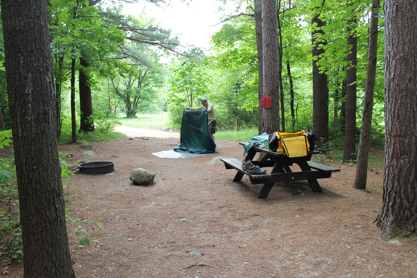
Our campsite is terrific. We have two adjoining sites. One is especially large and nice, and we end up using that for basically everything except the tent Dave and I will share. They are very close to level, with good spots for tents. Ted will be in one tent, Phil and Leo will share another. Phil has brought a little pavilion with a roof and sides that will be used as a combination changing room, storage area, laundry rack, and emergency rain hangout. Each site has a picnic table and a fire ring with fold down grill grate. This is all very standard, but is nicely maintained here. Being nestled in a mixed pine forest, the packed sandy soil is covered with a layer of pine needles, which makes for a very comfortable (and not at all messy) carpet.

Camp
We spend the rest of the early evening at various tasks and diversions, each doing our own thing. Some read, or just sit and chat. I wander down to the lake to take some pictures, some of us try for wifi access at the Loj (with limited success for me), and I take the time to write notes that will turn into these blog entries. If past experience is any indication, I will take good detailed notes earlier on and get briefer and sloppier later (in the end this will prove to be true). That's where digital pictures and being a persistent photographer come in handy; I can build timelines of our activities very accurately based on picture timestamps.

Sharing camp with us are a swarm of large chipmunks and small squirrels. The chipmunks are very bold in their quest for food, and will do everything short of climb up your leg. If you sat still enough, I am not convinced they wouldn't. Chipmunks are cute, and are very much preferable to the mice we have had other places.

Sundown, Heart Lake (8:18pm)
Dinner is a late meal of grilled chicken and a green salad. Phil has done a great job of planning out the menu and between good planning and a ready supply of ice, we will have fresh produce and veggies with every dinner. The chicken tastes great over an open fire. The only minor glitch with the meal is a little (ok, a lot) too much cooking time which turns a half dozen baked potatoes into large oval hockey pucks. This isn't a total loss, as it provides a good trigger for cooking-related teasing for the rest of the trip.

When dinner is over we clean up, stow all food and smellies in the van (to keep from attracting the resident black bears), and sit around the fire. We begin working our way through the assortment of beer that we have brought, and talk. Dave has recently purchased a "travel guitar", meaning a lower priced acoustic that he feels comfortable bringing on trips. It's actually a really nice guitar... Tonight, and throughout our time at camp, Dave will periodically pull out the guitar and play for a while. He has gotten very good and knows lots of songs. What we realize when attempting to sing along is that nobody seems to know the words to much of anything anymore, except Ted who remembers the words to most everything but doesn't really sing. Perhaps next trip we need a song list with cheat sheets for lyrics.

Fading Light, Heart Lake (8:30pm)
It is the first of many beautiful evenings, cool but not cold, with enough of a breeze to keep the campfire smoke from lingering. It is forecast to drop into the low 50's tonight, but we are all prepared and should be fine.

It's Grace's birthday today, and I have not been able to get a call through. Much Daddy guilt. I did trade texts with her this morning, so at least that is something. It would normally be the first day of summer and the longest day of the year, but since this is a leap year that all happened yesterday.

10:15pm - Tomorrow is expected to be the big hiking day, so Dave and I head to bed early, leaving the others to their drinks and conversation. I don't think anybody stays up too late. Quiet time begins at 10pm and ends at 7am by campground rules. The place isn't very crowded, and it does get quiet quickly. I sleep easily and well.

Next... Marcy Day

Adirondacks Day 2 (B) - Thurs 6/21/12

Part 4, Indian Pass Trail to Rocky Falls

Typical Adirondacks Trail
Once camp has been set, and lunch eaten, everyone is very anxious to get out on a trail and be moving. A quick look at a map shows one easy option which we settle on quickly: an out-and-back from the campground to Rocky Falls, a scenic spot a little under two and a half miles out the Indian Pass Trail. This trail passes the side trails to Mount Jo, a 2,900 foot mountain that overlooks the north end of Heart Lake and has great views of the big mountains to the south. (More on Mount Jo later).

1:30pm - Our hike begins right from our campsite (although I started the track map below at the information center), and after all the time in the van it is great to be moving. My only complaint, and it is a minor one, is that my left heel has been bothering me for the last few days, and I have no idea why. I have not been doing anything physical, and I don't remember feeling anything at any point, but my left heel in the area of my achilles and below my ankle is very sore to walk on. It is annoying, not limiting in any way, but it is persistent and doesn't go away.

Indian Pass Brook below Rocky Falls
The trail is exactly what the entire trip's trails will prove to be like. Well maintained trails through mixed pine and deciduous woods. As on other hikes, we are almost always completely shaded. This is a pretty level one, with only minor ups and downs as we very gradually climb up the valley that would eventually lead to Indian Pass and ultimately Henderson Lake. It is a warm and humid day, but being in the shade makes it not bad at all. The trail is sometimes dry, sometimes a little sloppy, but most low areas have stepping stones, flattened log bridges, or even sections of corduroyed trail (rows of small logs laid perpendicular to the trail). Any small feeder stream or runoff that we cross has a bridge of some sort. Everything is green or brown, with no other colors in evidence. Nothing is flowering at the moment. Photo opportunities are limited, as everything kinda looks the same, and there are no vistas or overlooks down here in the valley.

Rocky Falls
2:45pm - After a little over an hour of walking in the woods, we come to the side trail down to Rocky Falls and head toward the sound of water over rocks. We come out on Indian Pass Brook a few hundred yards below the Falls, and it is beautiful. I have always loved everything about water, and working our way up the rocky stream bed is the kind of scenic lift I have been waiting for.

As we come around a clump of trees, we hear a dog barking, and then voices. On the other side we see two bikini clad women sunning themselves on large boulders in the stream. This of course provokes rampant speculation that only the warning barks of the dog gave them enough time to get their clothes back on before we got there (among other things). I remain skeptical, but it is nice to be among my childhood friends and know that in our mid-to-upper-forties we are still children at heart. Boys will be boys, and apparently men will also be boys.

Intrepid Explorers at Rocky Falls
The Falls themselves are not overly large, but are very picturesque, and it is very nice the way they cut through a narrow chute in the rock on either side. There is a small tower cairn of rocks atop the Falls. The guys lament that on this hot day we do not have swim gear (or the privacy to go without swim gear) to take advantage of the nice swimming hole. The water is cold (but not frigid) and is very clear; exactly what you would hope mountain stream water to be. We stop and rest for a few minutes, enjoying the spot, and snacking on whatever we happen to be carrying. This would be a nice lunch spot. After a relatively brief stop, and some picture taking, we head back the way we came.
3:45pm - We arrive back at the junction with one of the side trails to Mount Jo, and it is decided that Dave, Ted and Leo will do that, while Phil and I head back to camp and start thinking about dinner and chores. The trail to the summit only adds a couple miles, but is a steep climb in places. My heel is still bothering me, and I figure I might as well save myself for tomorrow's big day. Phil and I stop at the store for ice and firewood, and are back at the campsite by 4:05.
Camp to Rocky Falls and Back - 4.6 Miles
4:30pm - Leo shows up back at camp ahead of Dave and Ted. He hasn't been feeling 100% recently, and decided that he would also stop the Mount Jo hike partway in and come back and rest up. Dave and Ted show up within the hour having summited Mount Jo (which they had also done on the last trip), and we all settle in for the evening.

Next... First Night at Camp

Adirondacks Day 2 (A) - Thurs 6/21/12

Part 3, Arrival at Heart Lake

Chapel Pond
The general plan for today is to get to Heart Lake (the Wilderness Campground at Adirondack Loj), set up camp, and get a "stretch the legs" hike in before the end of the day.

6:44am - We agreed to get up at 7 (or no later than...) this morning, but many of the gang are early risers and Phil arrives with a knock as Dave and I are still lying in bed dozing. He tells us that he and Leo have decided to run to Walmart early, and do we want to go along or is it alright for them to go. Without giving it much thought we say "go without us", but over the next hour or so it occurs to me that there were a few things I had planned on looking at, and I probably should have gone. They were little things, not even worth a phone call, and in the end it didn't matter.

"Chapel" geocache
7:19am - With Leo and Phil off shopping, there was no real urgent need to get moving, so I have flopped in bed for another half hour before getting up to shower. I am dressed and ready to go by 7:30, but it is 9:15 by the time the shoppers are back, everything has been gathered and the van completely reloaded. I don't know how we got even more stuffed into it...

We stop for a McDonalds drive through breakfast, and more importantly, coffee. Any time we are on the road in the morning, there seems to be an Egg McMuffin imperative, which I understand, as it is one of the few things at McDonalds that I like. It is a trip ritual if nothing else. We get back on 87 and roll north.

Unloading
10:20am - We stop at a rest stop 8-10 miles south of our exit, and I am happy to see that there is a cache here. While the others tend to business, I walk the 400 feet to the other side of the parking lot and make an easy find in a pine tree. "High Peaks North" is the cache, and it is my first in Essex county NY. There is also a cache at the exit, which Phil and I find, and which gives me a little poison ivy on one calf. We are off the interstate for good now, and heading deep into the High Peaks region on route 73, heading towards Lake Placid.

10:45am - We stop at a beautiful little mountain lake called Chapel Pond. It's a very nice spot, with a picturesque lake tucked in between the mountains and the road. I can't help wondering how deep it is. I take a few pictures, and Dave, Phil and I wander off into the woods just beside the road to find a geocache. While heading toward the cache, Dave sees a complete shed snakeskin in a rock crevice (it's about two feet long). We find the cache easily, which makes a total of 6, but we are all leery of reaching way under a rock to pull it out after seeing the snakeskin moments before. We are back on the road soon, driving between lovely forested peaks on all sides.

Home Sweet Home Away From Home
11:30am - A brief stop on the access road into the campground nets us cache #7. I am anxious to see what the campgrounds looks like, having heard the others talk about it.

11:45am - The Adirondack Loj serves as the office for the campground, and we stop to check in and pay the balance due on our two sites (campsites are in the neighborhood of $45 each per night). The Loj is right on Heart Lake, which is small but beautiful. There is an area for swimming, canoes and kayaks that can be rented for $5 an hour, and a wifi hotspot for internet connectivity (although this turned out to be pretty sketchy speed-wise). One thing I quickly find out is that the cell reception is not good at all. Calls are impossible, and text messages only go out once in a while, but fail more often than not. We are completely out of touch more often than not.

It doesn't take us long to set up camp, and after a quick lunch of sandwiches and chips, we are ready for that short hike.
Camp

Next... Rocky Falls Hike

Wednesday, June 20, 2012

Adirondacks Day 1 (B) - Weds 6/20/12

Part 2, Lake George

Leo, Dave, Ted, Phil
4:39pm - We left the rest stop south of Albany at 3:35, and arrive at our motel with plenty of daylight left. The motel is... ok... although the room Dave and I share doesn't smell so great. Blasting the air conditioning takes the edge off that however, and the price is right for a simple overnight stay. We have two rooms; one for the early sleepers (Dave and I) and one for the night owls (the other three). One thing we realize upon arrival here is that we didn't pack the car with any forethought to what we would want to get out of the van for this stop. We basically have to disassemble things to get at what we need (and consequently do so again to reload the following morning). If we had been thinking ahead, everyone would have had what they would need in their day packs, and all we would have wanted was one cooler with some liquid refreshment. Live and learn.

5:45pm - Having gotten what we need into our rooms, we hop back in the van for the short drive into town. The others have been here before, and they warn me that it is touristy and full of shops selling all sorts of junk, but that the lake is pretty and there are places right on the water where we can get something to eat. The consensus is that we are looking for wings and beer. That shouldn't be too hard to find.

Right around the corner from the motel, we stop and find a geocache, the first of three we will find in the town (and the first of eight overall for the trip).
Tourist steamboat from dinner deck

We park on the southwest side of the lake, right in the midst of everything, and quickly find a waterside bar and restaurant with a deck overlooking the lake. We settle in a order some drinks and an assortment of appetizers, including wings and steamers, as dinner. The wings are just the way they should be: crispy and lip-buzzing hot. It's a nice way to end a day, and we quickly settle into the familiar conversations and jokes. We have all known each other for a very long time, and everything is comfortable. We all have our quirks, but they are very well known and expected quirks. I have known Phil for about 30 years (maybe 31-32), Ted about 34, and Dave and Leo forever.

After finishing dinner, we make a second unsuccessful attempt to find an easy cache right outside the bar. When logging caches at home after the trip, I would see that the cache had gone missing and been disabled between the time I loaded my GPS and when we got there. If I had used my phone app, we would have known this, but I didn't think to do that.
Fort William Henry

Due to leap year, I think I saw somewhere that the summer solstice was at 7:09pm tonight, so it is the longest day of the year (not the 21st as usual). We have plenty of light left to take a leisurely stroll around the south shore of the lake, passing by the exterior of Fort William Henry. This area was extremely important in colonial and Revolutionary times, and seeing this old stockade fort was a nice bonus. There wasn't time to go in, even if it was still open at that time of the evening. The views birth up the lake were gorgeous as the sun faded.
Sunset over Lake George

9:00pm - Back in the night owls' room for a couple beers and some TV. Dave and I didn't last long and headed back to our room to write a little, read a bit, and then sleep.
Dusk with steamboat

Next... To Heart Lake

Adirondacks Day 1 (A) - Weds 6/20/12

Part 1, Preparing for Launch

Well, the boys trip 2012 is finally here, and I am very excited. The plan for today is to meet at Phil's house, about an hour north of me, at around 10:00am. Pending last minute work stuff that Leo may have to get through, we will leave as soon as we can, and drive as far north as the Rodeway Inn at Lake George, NY. We expect this will be about a five and a half hour drive if all goes well, with a lunch stop and other brief breaks as needed. This will leave only an hour and a half or so tomorrow to get to our final destination. There is a Walmart near the motel where we will be able to get the last of the provisions tomorrow morning, which will mainly consist of produce, eggs, cold cuts and other non-freezable perishables. I have bought a list of non-perishables ahead of time, and Phil has planned menus, prepped food, and frozen things ahead of time for most if not all of the main courses.

9:00am - I leave the house with what I think is a frighteningly large amount of gear. In the interests of being more flexible with packing the van, I have divided my personal stuff into two medium sized duffles rather than one huge one. In addition to this I have my day pack which contains various items including my good camera. I also have an inflatable air mattress (no larger than a true backpacking sleeping pad but much more comfortable. There is also one file storage sized box and three bags of non-perishables that I have bought for the group. And a camp chair. And a frying pan and an eight quart stock pot. It's a lot, and it's only my contribution.

9:30am - I get to Dave's to pick him up on the way, and when I pull into his driveway, he has an equally impressive pile of gear to bring. His personal items are about the same as mine, but instead of the non-perishables that I have, he has the tent we will sleep in and its accessories, and an acoustic guitar. He is hopeful that there will be room for the guitar, even if he needs to carry it all the way on his lap. Our combined pile of stuff pretty well fills my post-car-accident rented Altima.

As we are loading the car, I comment that we will almost certainly need the roof rack clam shell this time. Dave points to the far wall of his garage, against which the roof rack is leaning, and says "yeah, about that...". It seems that the rooftop carrier that I am thinking we will be using is actually Dave's, not Phil's, and as it is sitting in Dave's garage with no way of getting it to Phil's, the only way we will be able to use it is to bring the van back down to Dave's house. This is an hour out of the way, not to mention the extra time to fiddle with it. We shrug and hope we can find a way to not need it.

10:05am
- Dave and I arrive at Phil's. Ted pulls in almost at the same time as us. We put all the combined gear together and organize it to be ready to load when Leo arrives. We have a rented Dodge Grand Caravan, the same vehicle that we rented for the Dakotas trip last year, where it proved to be a comfortable workhorse. It's a mountain of stuff, and we hope that Leo has packed light.

When Leo shows up at around 10:30, he hasn't packed any lighter than any of the rest of us. The mountain grows. We have all the personal stuff, boxes and bags of food, 3 loaded coolers, many cases of water, Gatorade and beer. And a host of other things. I can't believe it will all fit, but after a half hour of fiddling, we manage to have it all in. I'm still not quite sure how we did it, but Dave did have to ride the whole way with a guitar between his legs.

11:01am - We leave Phil's, happy to be on the road in very good time. A quick stop at the rental place to add me as a secondary driver and we are on the way.

12:09pm - Having travelled up the Northeast extension and over on I-78 East, we cross into NJ.

1:00pm - We have come up I-287 and stop at the Wendy's just off the Hanover/Whippany exit for a quick lunch.

1:30pm - Back on the road again.

2:00pm - Into NY.

3:20pm - We stop at the New Baltimore rest stop just south of Albany to stretch our legs. We are making good time, as the speed limit on most of the non-urban interstate is 65, which means Phil can go 80 ish most of the time and be moving with traffic.

Next... Lake George

Saturday, June 9, 2012

Attitude Adjustment

Mount Marcy. The highest point in the Adirondacks, and the highest point in New York state. I have to admit that the idea of a 15 mile hike with 3,200 feet of elevation change on the way up and the same 3,200 feet on the way down has been weighing heavily on my mind. I was in decent shape for the Dakotas, but not as good now. And I have done very little hiking this year. Or anything that uses my legs really, not even geocaching in local parks and woods. So I can't exactly pretend that I am prepared physically.

Rereading Dave's blog posts earlier today from the last trip on these same trails was not particularly helpful, as he characterizes it as the hardest hiking he has done (and I know that nothing in the last four years has changed his mind). So I wouldn't exactly say that I am prepared mentally either.

This made me feel pretty gloomy about my prospects of accomplishing this, but also made me realize what I need. I need an attitude adjustment. There is no sense in dreading what should be one my most memorable hiking achievements, and the high point (literally) of a wonderful vacation trip. If I believe I can't do it, then I won't. If I believe that I can, even if I shred a couple of knees in the process, then I will. And so I will. I will go as slow as I need. I will take as many breathers as I need. I will lag behind the rest of the group if I need. But I will get to the top of Mount Marcy. I will.

Fast Approaching

It is less than two weeks until we leave for the Adirondacks trip, and the excitement has finally kicked in. For whatever reason, with everything else that has been going on, I just haven't been thinking about the trip that much, and when I have, it has just been this distant recognition. But within the last week, that has changed.

Heart Lake, site of our campground
Last Monday, I sent an email to the guys asking for suggestions on a non-perishables shopping list that we could tackle ahead time so that we had all that out of the way. The resultant flurry of emails is what made the trip seem imminent. With that came the excitement. Perhaps concrete planning makes it seem more real, I don't know. But whatever it was, it came on strong.

A lunch trip to a nearby Eastern Mountain Sports store netted me a couple of maps of the area, including the Trails Illustrated map of Adirondack Park (Lake Placid / High Peaks). I also placed an order from Amazon which was delivered in a remarkable three days. For background reading, I now have Discover the Adirondack High Peaks by McMartin and Ingersoll, and the guidebook Adirondack Trails, High Peaks Region (13th edition), edited by Tony Goodwin. This second book covers the hiking trails of the region in great detail. So I have some reading to do.

I also still have a few things to buy, but nothing major. I went through all my camping gear and hiking clothing and am in good shape other than the need to have some warmer layers. The Dakotas trip had no real expectation of things getting cold. Here, there is that chance. And bad weather could set in during hikes or on the mountains, which has happened to these guys before. So some additional layering items are needed.

The packing list that I made for the Dakotas needs a little bit of tweaking, which I have been doing, as this is a shorter trip, but that list serves as a good starting point, and prevents me from having to start from scratch. I have begun setting aside some of what I need, and will do more this weekend.

I still have concerns over my fitness level, but there's nothing to be done about that at this point. On the bright side, Dave's back is apparently doing very well and he says he's just about 100%. I hope that holds for him.

Speaking of Dave, I have gone back and read his posts about the last Adirondacks trip in June 2008, and found it especially interesting given that we will be staying at the same campground and climbing at least one of the same mountains. All of a sudden, this makes Dave's posts very real to me. Anyone interested in what's in store for me should go to Dave's Musings and read the posts here.

Thursday, June 7, 2012

Book Review - The Cove

As I have noted before, Ron Rash has become one of my favorite authors, and when I saw on Amazon that he had a new novel out, it didn't take me long to order it, get it, and devour it. The Cove is set, as usual, in the western Carolina mountains, this time in the closing days of World War 1.

The namesake cove of the title is a canyon-like valley in the shadow of granite cliffs set into the mountains. It is a dark and gloomy place, believed haunted by the superstitious locals. Brother and sister Hank and Laurel Shelton are doing their best to improve the hardscrabble farm they have inherited from their parents. Hank is soon to get married, and Laurel is a lost soul, shunned as a witch because of the pronounced birthmarks that she has and where she lives. Things begin to change for the Sheltons when a mysterious mute stranger shows up one day, ends up staying for a while, helping around the farm, and having Laurel predictably enough fall in love with him. I won't say much about how the book ends, but there is a certain inevitability to the plot, as the things that have been set in motion roll inexorably downhill toward their conclusion.

The book is as well written as all of Rash's are, and the pages flew by for me. It deals with themes of the nature of war, duty, honor, etc..., as well as family, prejudice and intolerance. I enjoyed the 250 pages very much, but if I were to have any complaint at all, it would be that it was somewhat predictable, especially given Rash's other works. Rash's world is a very sobering place; a place where bad things happen to bad people, and bad things happen to good people. There are strong elements of tragedy in most of his novels and stories, and the cold dark hand of fate hovers over the end of most of his books including certainly this one. That being said, they are still great stories, great reads, and some of my very favorite books.

I would give this 3.5 stars out of 5, perhaps even 4 out of 5, more on the basis of predictability than anything else. A very worthwhile read.

At the same time I ordered this, I also got two other novels: In One Person by John Irving and Canada by Richard Ford. Both are brand new novels from big name authors I have read before. I am a few chapters into Canada as I write this.

Sunday, June 3, 2012

The Checklist Manifesto

I did something I rarely ever do: I read a non-fiction book that wasn't history. Atul Gawande, a surgeon who writes frequently on medical issues for The New Yorker, has long been a favorite of my wife's. She reads pretty much anything he writes, in the magazine or books, and has recommended him to me many times. Since this isn't the kind of thing I generally read, I haven't read anything of his other than a couple of single articles.

For whatever reason, I picked The Checklist Manifesto; How to Get Things Right (2009) off the bureau the other day and plowed through it in a couple of days. It was very well written with a bunch of interesting stories supporting his general theme. The theme is that in an age of mind-boggling complexity and sophistication, something as basic as a well constructed checklist can do wonders for helping us not make mistakes, i.e. "get things right". The book revolves around Gawande's role in helping to create a basic surgical checklist for the World Health Organization that could be widely distributed and cut back on the number of avoidable surgical errors occurring in countries all over the world.

Complementary stories include the building of modern day huge buildings, flying the WW2 era B-17 bomber, how an upscale restaurant kitchen functions, and the controlled crash landing of a US Airways A320 in the Hudson River.

It was 193 pages of fascinating stuff that made me wonder how I could apply some of these learnings at work. On second thought, perhaps reading a book and then thinking about work lying in bed at night is why I don't read these kinds of books. But all kidding aside, it was worth it.