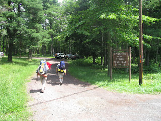
The Pinchot Trail Chronicle, Part 15
Tuesday June 29, 2010
9:30am - We are climbing the long gradual ascent out of the Choke Creek valley, and we come to the intersection of the Choke Creek Nature Trail (which heads north) and the Butler Run Trail (which heads off to the southeast). The Butler Run Trail is the Pinchot Trail, which we had planned to follow, but we depart from the original plan at this point and head north up the Nature Trail.
9:48am - Having crossed swampy little Butler Run, we arrive at the place where the Nature Trail becomes a grass forest road. We will be following this kind of grass road for a total of about the next mile, which will make the going easier on my knees, which have settled into a painful soreness, but this is what I expected. It's not all that pleasant, but I have grown accustomed to it and have no doubt I can finish up the modified loop we have planned. We take a pack break at this junction until 10:02am.
10:17am - Still on grass forest road, we cross the dirt and gravel Tannery Road and skirt the Spruce Swamp Natural area on the west side. On this stretch of grassy road, we pass the third and final clear evidence of bears. Bears do indeed...in the woods. In some quantity, apparently.
10:29am - At the far side of the Spruce Swamp Natural area, we rejoin the Pinchot Trail, which is named the Sunday Trail at this point, and which becomes the Stone Lookout Trail as we turn left into the woods. We begin a modest climb around the eastern shoulder of a rocky hilltop, coming out into a clearing on top at around 10:45am, and see the so-called Stone Tower ahead of us. This plateau at the top of the hill is beautiful. There are large stretches of flat exposed bedrock, and everywhere else is covered with a profusion of wild blueberry bushes.
The descent down the western slope of the Stone Tower hill is painful, as are all down grades.
11:10am - We pass the sign indicating that we are now on the McClintock's Gate Trail, the final named trail section, which means we have less than a mile left to the blacktop road. My knees are extremely sore, but not so much so that I cannot appreciate the sights that we see as we pass by. Because of the bright sun, blue skies and puffy white clouds, some of the open meadows of mountain laurel that we pass through are the nicest of the trip.
The field shown below was one of my favorite sights of the entire trip - a beautiful sky framing the trail as it passed through acres of mountain laurel, some of it in bloom.
11:47am - We come out of the woods onto the last stretch of the dirt and gravel Tannery Road, and within a minute are at Bear Lake Road, the blacktop road that bisects the State Forest. Half a mile to the parking area. As we hike along the shoulder of the road, the combination of level ground, smooth surface, and the thought of having survived the day make the pain in my knees disappear for a while.
11:57am - We hike past the sign for the Pinchot Trailhead Parking area and are back at the car. A trio of mountain bikers are kind enough to snap our picture for us, and then we gladly drop packs and equipment in a pile on the ground. I have never been so happy to peel off a set of sweaty wet clothing and get into a nice soft cotton t-shirt and shorts.
We did it. It was not exactly as I had imagined it, but it was great fun, and I can't wait to do it again. After my knees feel a little better that is.
Next...Aftermath and a Recap


No comments:
Post a Comment