Showing posts with label Highpoint. Show all posts

Saturday, June 14, 2014

West Virginia - Saturday part 1 - Spruce Knob

One of the early potential plans for this trip was to hit three state highpoints in one outing; Mt Davis in Pennsylvania, Backbone Mountain in Maryland, and Spruce Knob in West Virginia. On further research, it was agreed that the first two weren't very interesting or especially good hikes. This left Spruce Knob in WV as the one highpoint we wanted to get. That was the goal for Saturday.

5:20am - I have slept restlessly in the hotel, as I usually do, and this is the first time I remember looking at the alarm clock.

6:20am - I am dozing off and on, but it will be time to get up soon so we can get going. We have about 2:40 of driving to get to the day's hike at Spruce Knob.

6:45am - Time to hit the showers and get dressed.

7:15am - Dave and I are ready, but Leo is in the shower. To kill time before meeting up for breakfast in the hotel's little breakfast area, Dave and I decide to go to the gas station/convenience store (a Sheetz) across the street to gas up and fill the coolers with ice. While we are out we grab a quick geocache in the parking lot of a fast food place down the street from the hotel. I have cache finds in Virginia already, but only in the eastern part of the state, so this will be a new county (geek, I know...). This will be the first of a modest seven geocache finds on the trip.

8:40am - We have had the simple complimentary breakfast at the hotel and are on the road. Not quite as early as I had thought we might be, but still on target to be hiking by noon.

The ascent into the West Virginia mountains is a nice drive. We are on highways for a little while, but soon we are on two lane roads, working our way through gaps and down the valleys between mountain ridges. The scenery is beautiful, but the driving is slow for the miles we are covering. Sharp curves, no passing zones and some rubber-necking at the views. That's why it's a two hour and forty minute drive to our destination. At about the 2 hour mark we drive past our campground at Seneca Rocks and continue on to Spruce Knob. The final approach road up the mountain to the state highpoint is quite a ride: switchbacks, steep narrow roads and blind curves for miles.
Spruce Knob Observation Tower

11:30am - We arrive at the parking lot for Spruce Knob. The actual highpoint with its observation tower is only about 300 yards from a parking lot. We hit the high point before our hike (at 4,863 feet). There is a traditional cache along the gravel path to the tower, so Dave and I now have a cache in West Virginia. This is my 23rd state. Woo hoo. I also gather the required information for an earthcache (a geology-based educational kind of geocache). The view from the tower is amazing, with wooded ridges as far as the eye can see. It's a beautiful day, with blue skies, fluffy white clouds, and a nice cool breeze.
View from the Tower

11:54am - We set off down the Huckleberry Trail. The trails in the Spruce Knob area (and there are many of them) are laid out in such a way that a loop or circuit hike isn't really an option. We could do a shuttle hike (from one car to our other car parked at a different trailhead) but we opt for a simple out-and-back along the ridge top Huckleberry trail for as long as we choose.
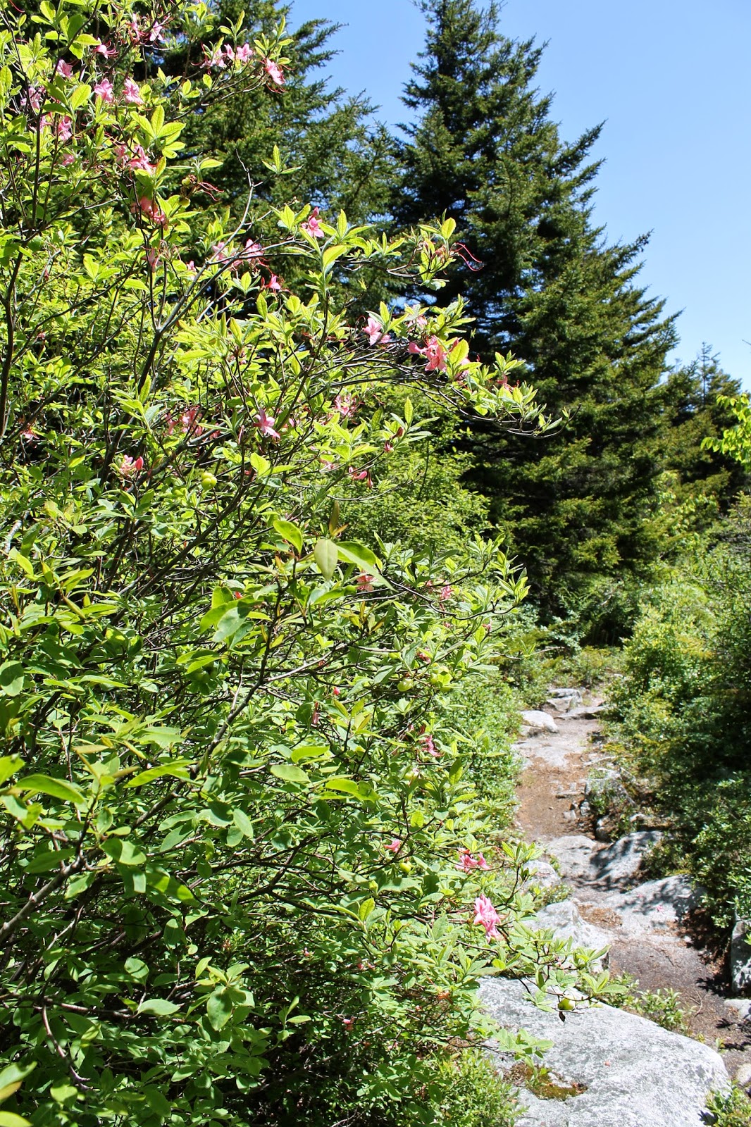
Spruce and head-high azaleas

The hike is a nice easy one, through stands of red spruce and upland forest intermingled with mountain meadows of laurel and azalea. We are following the ridge line, and are descending very slowly away from the highpoint. In effect, we are doing part of hike #45 on page 238 of the Falcon Guide Hiking West Virginia (2nd edition, 2013). That hike is a shuttle from a trailhead on the Seneca Creek Trail along the creek for 5 miles or so (down in the valley between the ridges) and then up onto to ridge top to meet the Huckleberry Trail, and then 5 miles up the Huckleberry to the highpoint. We are doing the Huckleberry piece as an out and back.
Green everywhere

12:57pm - Approximately 3.1 miles north out the Huckleberry Trail we stop for lunch in a beautiful mountain meadow. [Have I mentioned how great digital photos are at time stamping everything?]. The view west across the valley to a distant ridge is amazing. Lunch itself is ham and cheese sandwiches and various trail snacks. Conversation is a train of consciousness blend of movies in general, James Cameron movies in specific, Game of Thrones and miscellaneous strolls down memory lane. The thought occurs to me as we eat that even though I don't see Leo as often as I would like, and see Ted almost exclusively on these trips, I am as comfortable around these three guys as any other people I know. Lots of shared history in 48, 47 and 35+ years...
Lunch in a mountain meadow

1:31pm - Lunch break, conversation, airing of boots and socks, and enjoying the view is done. We hit the trail and continue North.
The view West from my lunch seat

2:10pm (ish) - At around mile 4.5 of our hike (courtesy of my Garmin 450t GPS track), we begin to drop steadily off the ridge into the valley to our west (left). Dave and Ted voice the opinion that further out means further down, and that what goes down (in this case) must come back up. Given that we are planning the big hike of the trip to be tomorrow in the Dolly Sods Wilderness ("Dolly til we drop" as Leo puts it), it is suggested that we turn around and head back. Leo is amenable. I am relieved. I was enjoying the views, the forests, and the easy hiking, but once it was brought to my attention I realized that a 9 mile day today was just fine with me. More would be...more. And so we headed back.

Spruce Knob - 8.9 miles
Along the way I checked my GPS with preloaded geocaches and saw that we had passed a cache on the way out the trail, 0.8 miles from our starting point. At some point on the return trip Ted and Leo separated from Dave and I. I wasn't struggling at all, but my pace on climbs, even modest ones, does slow down. Dave stuck with me. I'm sure he didn't need to, but I appreciated the company. We found the cache we had passed on the return trip after a brief search of a boulder field.

3:43pm - We are back at the starting point, 3:49 after setting out, including a 35 minute lunch break. The GPS says we have covered 8.9 miles, or a pace of about 2.8 miles per hour (taking out lunch).

My legs are a little sore from the mileage, but I feel great. It's always terrific to be out in the woods with the guys.

Next...Saturday part 2...Seneca Shadows Campground.

Saturday, June 9, 2012

Attitude Adjustment

Mount Marcy. The highest point in the Adirondacks, and the highest point in New York state. I have to admit that the idea of a 15 mile hike with 3,200 feet of elevation change on the way up and the same 3,200 feet on the way down has been weighing heavily on my mind. I was in decent shape for the Dakotas, but not as good now. And I have done very little hiking this year. Or anything that uses my legs really, not even geocaching in local parks and woods. So I can't exactly pretend that I am prepared physically.

Rereading Dave's blog posts earlier today from the last trip on these same trails was not particularly helpful, as he characterizes it as the hardest hiking he has done (and I know that nothing in the last four years has changed his mind). So I wouldn't exactly say that I am prepared mentally either.

This made me feel pretty gloomy about my prospects of accomplishing this, but also made me realize what I need. I need an attitude adjustment. There is no sense in dreading what should be one my most memorable hiking achievements, and the high point (literally) of a wonderful vacation trip. If I believe I can't do it, then I won't. If I believe that I can, even if I shred a couple of knees in the process, then I will. And so I will. I will go as slow as I need. I will take as many breathers as I need. I will lag behind the rest of the group if I need. But I will get to the top of Mount Marcy. I will.

Saturday, August 20, 2011

Highpointing - Ebright Azimuth, DE

One of the things that the hiking boys bring up often in conversation of places to go and things to do relates to doing the high points in various states. I know that I had done very few if any of these prior to the recently completed Dakotas trip, although I know that I have been very near the Delaware state high point (such as it is). Highpointing and geocaching overlapped today.

When on the geocaching website earlier today, I saw an announcement that today was the first annual International Geocaching Day, and that anyone logging a cache today would get a special souvenir badge on their profile. Not a big deal, but a good excuse to get the girls out and find a couple of the newer caches in the area that I haven't cleaned up yet. We ended up going out with one of Grace's friends in tow and found two simple caches. One of the caches is at the location shown in the picture, which at 448 feet above sea level is the highest point in the state of Delaware. That make two official high points for me. Ebright Azimuth, Delaware, the second lowest (only Florida's is lower), and Harney Peak in South Dakota (the 14th highest at 7,242 feet).

While we were looking for the geocache, a nice older lady came out of a nearby house, asked if we were "highpointers", and proceeded to tell us some history of the area, handed us a bunch of pamphlets and information on highpointing, and had us sign the official Delaware state highpoint logbook. Fun. We also get to claim the badge for the special day today. Not a bad hour's work.

Monday, August 1, 2011

Harney Peak Summit

Dakotas Day 4 - Monday August 1, 2011 (Part 2)

9:01am - We climb the last few sets of man made steps and iron stairs, and come out on top of Harney Peak. It is a beautiful day, a nice accomplishment, and the view is breathtaking. I am grateful to be up here on such a nice day with perfect weather to enjoy the spectacular view, remembering all too well Dave's tales of summiting Mount Marcy in NY in awful weather with fog cutting the view down to nothing. The exact opposite is true here and I feel like I can see halfway to forever. The view is of pine forest and weathered granite hills as far as the eye can see. Sights like this are why I like to hike, and what make those hard-work climbs worth it.

There is a thing called Highpointing, which is to climb to the top of the highest point in each state. I know that Dave and the others have talked about checking some of these off their lists (notably Mount Marcy in the Adirondacks of NY and Clingman's Dome off the Appalachian Trail in TN), but to my knowledge at this point, this was my first one. A little research once I got home would prove this out; Harney Peak SD is the 14th highest state highpoint, and my first.

Enjoying the thrill of being in such a beautiful place, we have a group picture taken by a nice family, and then return the favor for them. We then explore the stone fire tower built by the Civilian Conservation Corps in 1939. It is no longer is service, and is rundown in some places, but is a very picturesque building in an amazing location.

There is also an "earthcache" type of geocache up here. An earthcache is a type of cache that is generally geology based, and can be of varying levels of complexity, ranging from answering a few questions about what you see at specific locations to things that seem like they should be term papers for college geology courses. This is a relatively easy one, and I wander around a bit to take some notes and fulfill the requirements. As I am doing so, I am startled to see a chipmunk on the stone steps right next to me. I would have thought of these as woodland creatures from back home, but I have always liked chipmunks, and take this as a good omen.

There is also good cell reception up on top of the mountain, which is somewhat of a rarity around here, so I do the sacrilegious thing and make a call and send some text messages. Oh well, as I have said, this doesn't bother me at all, regardless of what others might think.

9:20am - Lunch time. With the hard work we have done this morning, everybody is ready for a meal, no matter what the time of day. Call it lunch, call it second breakfast, the only thing that was important was that it was one of the tastiest sandwiches and granola bars I have ever had. Location location location. Eating our lunch out on the rocks behind the tower did bring with it something else...chipmunks in droves. It seems that the cute little one I saw back on the stairs was a scout for an invading army. As soon as we sat down to eat, chipmunks came at us from every direction, boldly darting toward our backpacks, sneaking up behind us, and doing everything they could do to get near our food. At any given time there were at least half a dozen in sight. It was kind of funny until it became annoying.

9:45am - As great as the view is, we have a lot to do yet today, and are anxious to continue on with our hike. I stop to take in the views one last time before heading back down the mountain. I am sorry to have to go, as I feel like I could spend the rest of the day up here. Or the rest of the week for that matter. Yes, I am sappy and sentimental.

10:02am - We are down off the peak, and have backtracked to the point where the Harney Peak Trail splits either southwest back along the Sylvan Lake Trail (the way we came), or south along the Norbeck Trail to its junction with the Little Devils Tower Trail. We have all decided that we are feeling good and rather than backtrack our ascent route, we should take the Little Devils Tower trail. So we shoulder our packs and head south.


Next ... Little Devils Tower